ESSO - Indian National Centre for Ocean Information Services
(An Autonomous Body under the Ministry of Earth Sciences, Govt. of India)
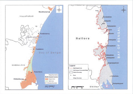
Multi hazard Vulnerability Mapping
The Multi-Hazard Map is a "composite, synthesized and overlay of multiple hazards"
Objectives
- Multi-hazard vulnerability assessment
- Generation of the Multi-hazard Vulnerability Maps (MHVM) using shoreline change rate, extreme sea level and high resolution topographic data
- Generation of the MHVM atlas
- Spatial statistics of the MHVM
Deliverables
- Multi-hazard Vulnerability Maps of the Indian coast
- Atlas of the Multi-hazard Maps
- Spatial Statistics at different administrative levels
Case Studies