
ESSO - Indian National Centre for Ocean Information Services
(An Autonomous Body under the Ministry of Earth Sciences, Govt. of India)
Status Of ElNino
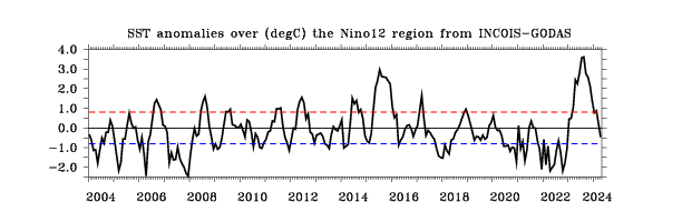
Figure Sea Surface Temperature anomalies (ºC) of NiNO 12 (10°S-0°N & 90°W-80°W) region. Anomalies are with respect to 30-year mean OISST
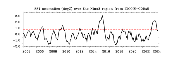
Figure Sea Surface Temperature anomalies (ºC) of NiNO 3 (5°S-5°N & 150°W-90°W) region. Anomalies are with respect to 30-year mean OISST.
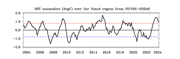
Figure Sea Surface Temperature anomalies (ºC) of NiNO 4 (5°S-5°N & 160°E-150°W) region. Anomalies are with respect to 30-year mean OISST.
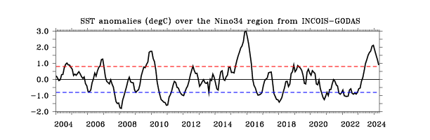
Figure Sea Surface Temperature anomalies (ºC) of NiNO 3.4 (5°S-5°N & 170°W-120°W) region. Anomalies are with respect to 30-year mean OISST.
NINO Indices based on INCOIS-GODAS SST analysis and Monthly climatology of OISST (Reynolds sst;constructed using 1981-2010 data).
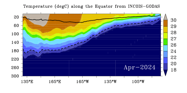
Figure Depth-longitude section of the (5ºS-5ºN) region averaged temperature (ºC) for the latest month for the Pacific Ocean longitudes. The continuous black line represents the mixed layer depth, and the dashed black line indicates thermocline depth (20oC isotherm).
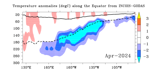
Figure Depth-longitude section of the (5ºS-5ºN) region averaged temperature anomaly (ºC) for the latest month for the Pacific Ocean longitudes. Anomaly is computed with respect to WOA09 monthly climatology.The continuous black line represents the mixed layer depth, and the dashed black line indicates thermocline depth (20oC isotherm).