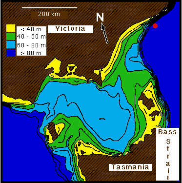
Topography of Bass Strait. Depth contours are drawn every 10 metres. The red dot indicates the location of the station shown in Figure 9.9. Adapted from Baines and Fandry (1983).
contact address: