Select the Info tool  from
the bottom toolbar.
from
the bottom toolbar.
Click on a feature of interest in the map image.
The Info tool allows users to obtain information for features in select layers on the map. Information may include the name of the feature as well as other information contained in the database for that layer.
To obtain information using the Info tool:
Select the Info tool from
the bottom toolbar.
Click on a feature of interest in the map image.
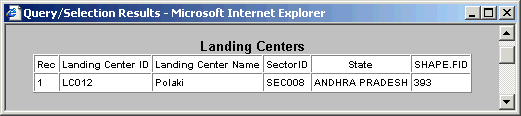
A new browser window will appear containing information specific to the identified feature/s i.e., one or combination of Tuna fishery forecast lines, (TUFFS lines) bathymetry lines, Sectors, Light houses, Landing centers etc.
Figure showing the details of Tuna fishery forecast System, (TUFFS lines).
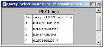
Figure showing the details of Sector information.
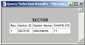
Figure showing the details of Bathymetry lines.
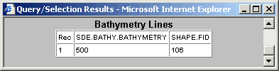
Figure showing the details of Light houses
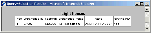
Figure showing the details of Landing centers
.