
Coastal Topography, Bathymetry &
Modelling
ØCMAP,
GEBCO, SOI, RTK Survey Data being used.
ØALTN data for 250 sq km
ØBathymetric Survey conducted for a few vulnerable areas. Detailed survey being planned for other areas.
ØTunami N2
Model has been customised and validated
by ICMAM
ØCoastal
Inundation scenarios being simulated
for 5 historical Earthquakes
1m contours overlaid on ortho image
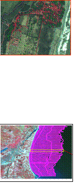
Base map overlaid on ortho image
Bathymetric Survey for Cuddalore
