According to Menzies (2003) a Venetian map of 1428, which is now lost, showed the coasts of all continents surveyed by the Chinese fleets. A portion of it covering the west coast of South America (a region Columbus never visited) and some notes about the map from Christopher Columbus' hands ended up with a Spanish seaman from Columbus' fleet.
The seaman was captured by the Ottomans in 1501. The Ottoman admiral Piri Reis recognized the value of the map and combined it with other sources into a map of the world now known as the Piri Reis map of 1513.
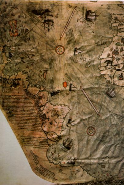
The detail of the Piri Reis map shown below covers part of the Atlantic Ocean. Africa is on the right, the west coast of South America on the left. The map includes the "Strait of Magellan" at the bottom left, together with the ice limit encountered by the exploring fleet. Menzies argues that all this information was available to the Spanish and Portuguese explorers.
Menzies, G. (2003) 1421, the Year China Discovered America. Harper Collins, New York.