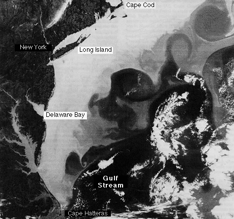
Satellite image of sea surface temperature for
the Middle Atlantic Bight for 1 May, 1977. Dark is warm,
speckled white areas in the lower right are clouds. The black regions on the left show the warm land from Cape Cod in the north to Cape Hatteras in the south, where the Gulf Stream separates from the shelf.
Adapted from Beardsley and Boicourt (1981), courtesy of R. Legeckis; reproduced by permission.
© 1996 - 2000 M. Tomczak
contact address: