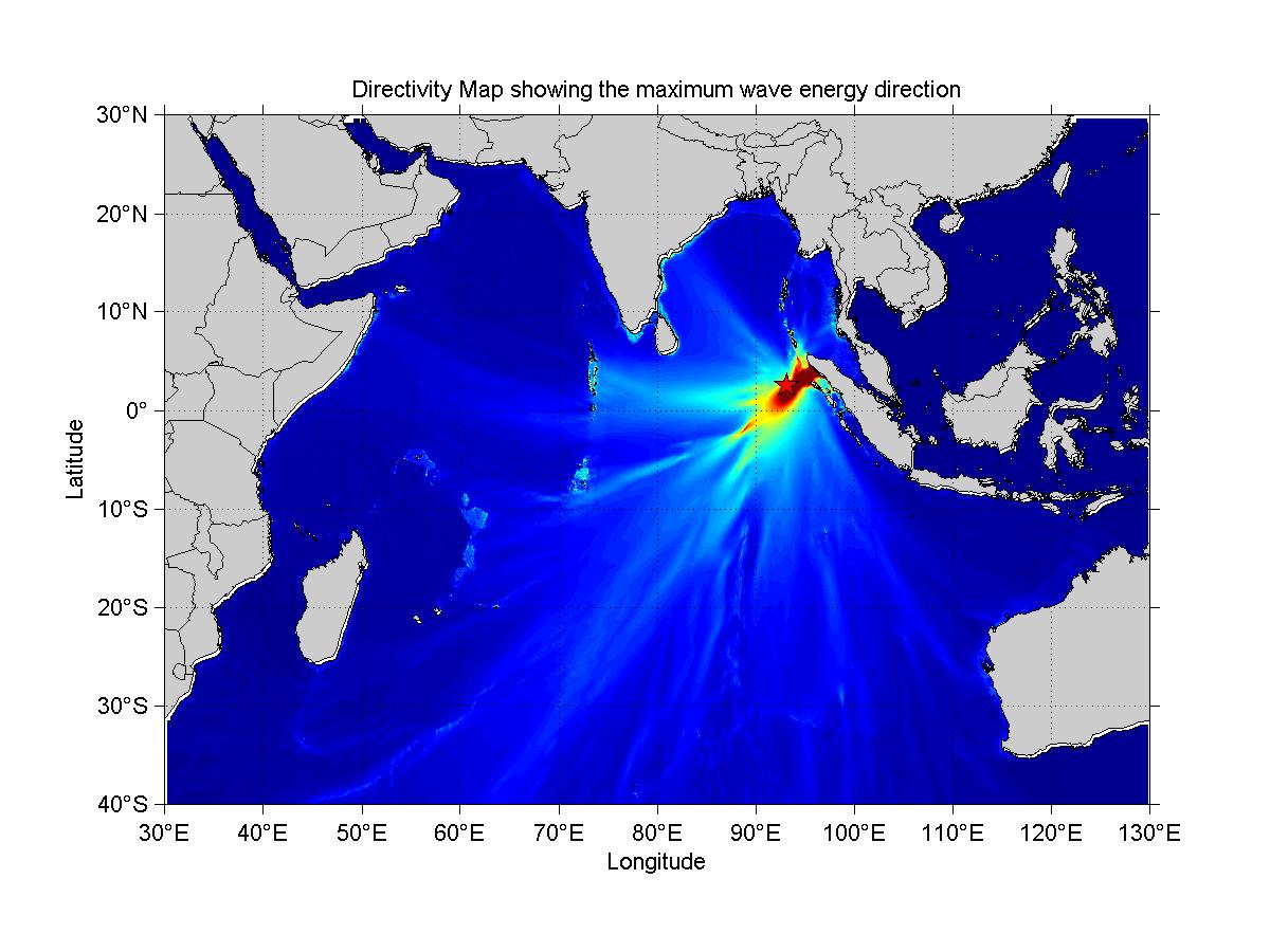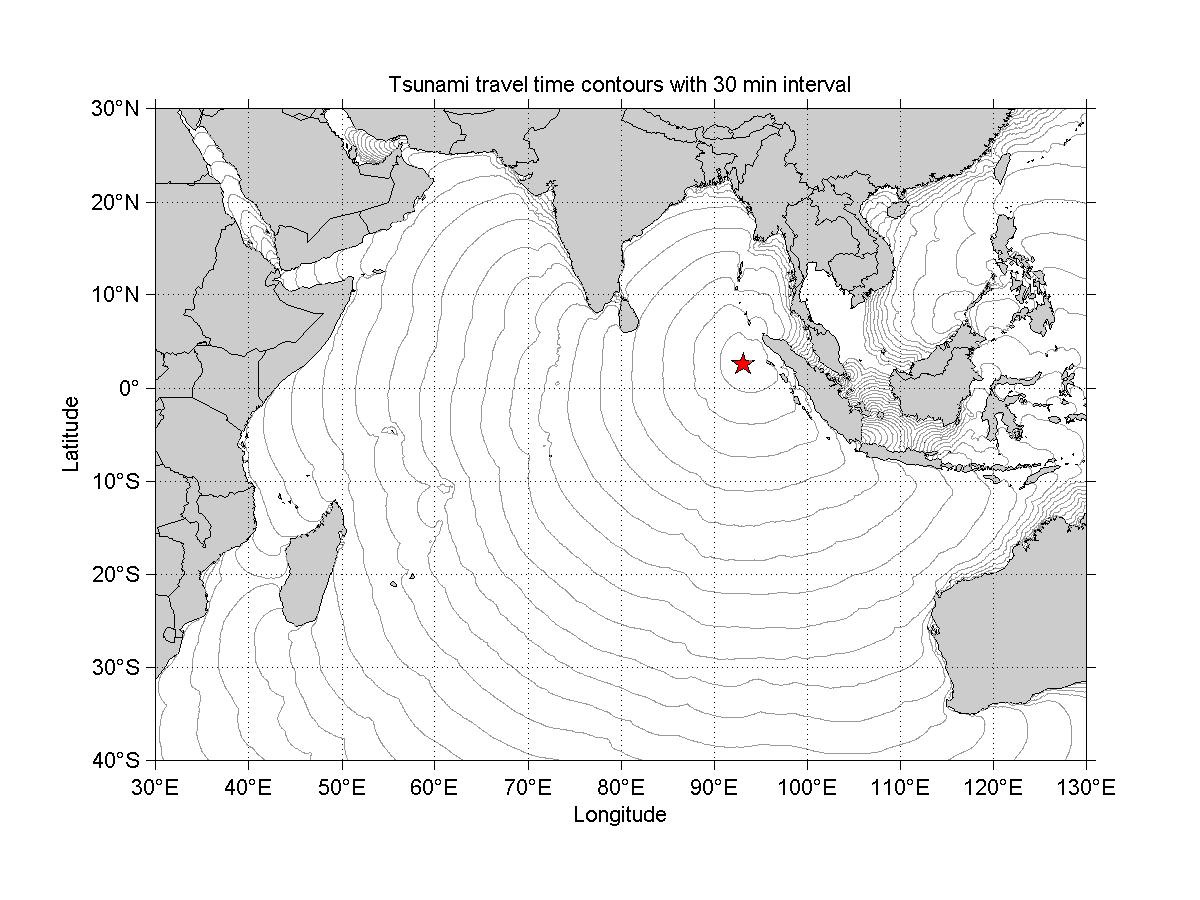

KML

TXT

DBF
NTWC-INCOIS-20120111-0007-002 (TYPE - II)
INDIAN TSUNAMI EARLY WARNING CENTRE INCOIS HYDERABAD (ITEWC)
Issued at: 0017 IST Wednesday 11 January 2012
| EARTHQUAKE INFORMATION (Revised) | |
|---|---|
| Magnitude (Preferred) : | 7.1 (Major) |
| Network Magnitude(s): | 7.3 (MLv), 7.1 (Mwp), 7.4 (Mw(Mwp)), 7.3 (mB), , 7.3 (Mw(mB)), 6.7 (mb), 7.3 (M) |
| Depth: | 10 km |
| Date : | 11 Jan 2012 |
| Origin Time: | 0007 IST |
| Latitude: | 2.5 N |
| Longitude: | 93.19 E |
| Location: | off W Coast of Northern Sumatra |
| Land/ Ocean: | Ocean part |
| Water Level Depth (if Ocean): | 4395 m |
| EVALUATION |
|---|
Earthquakes of this size sometimes have potential to generate tsunamis. However, so far there is no confirmation about the triggering of a tsunami. An investigation is under way to determine if a tsunami has been triggered. ITEWC will monitor sea level gauges and report if any tsunami wave activity has occurred. Based on pre-run model scenarios, the zones listed below are POTENTIALLY UNDER THREAT. |
| TSUNAMI THREAT FOR THE INDIAN COAST |
|---|
The list below shows the forecast arrival time (T) of the first wave estimated to exceed 0.02 m amplitude in case of "watch", 0.5 m amplitude in case of "Alert & Warning" at the beach in each zone, and the amplitude of the maximum beach wave predicted for the zone. Zones where the estimated wave amplitudes are less than 0.2m at the beach are not shown.
The list is grouped by State (alphabetic order) and ordered according to the earliest estimated times of arrival at the beach.
Please be aware that actual wave arrival times may differ from those below, and the initial wave may not be the largest. A tsunami is a series of waves and the time between successive waves can be five minutes to one hour.
The threat is deemed to have passed two hours after the forecast time for last exceedance of the 0.5m threat threshold for a zone. As local conditions can cause a wide variation in tsunami wave action, CANCELLATION of national warnings and ALL CLEAR determination must be made by national/state/local authorities.
|
| PLACE NAME | DISTRICT | STATE / UNION TERRITORY |
T(IST) |
Amplitude(m) | Threat Status |
|---|---|---|---|---|---|
| INDIRA POINT | INDIRA POINT GREAT & LITTLE NICOBAR ISLAND | ANDAMAN & NICOBAR | 11-Jan-2012 00:44 | 0.2 | Watch |
| ADVICE |
|---|
|
For regions under WATCH (Yellow), no immediate action is required For regions under NO THREAT (Green), no action is required This bulletin is being issued as advice. Only national/state/local authorities and disaster management officers have the authority to make decisions regarding the official threat and warning status in their coastal areas and any action to be taken in response. |
| UPDATES |
|---|
|
Additional bulletins will be issued by NTWC INCOIS for this event as more information becomes available. |
| CONTACT INFORMATION |
|---|
|
Indian Tsunami Early Warning Centre (ITEWC) Indian National Centre for Ocean Information Services (INCOIS) Address:"Ocean Valley", Pragathi Nagar (BO), Nizampet (SO), Hyderabad - 500 090, India. Tel: 91-40-23895011 Fax: 91-40-23895012 Email: tsunami@incois.gov.in Website: www.incois.gov.in |
Elapsed Time: This Earthquake happened 00 Hours, 10 Minutes, 17 Seconds ago

